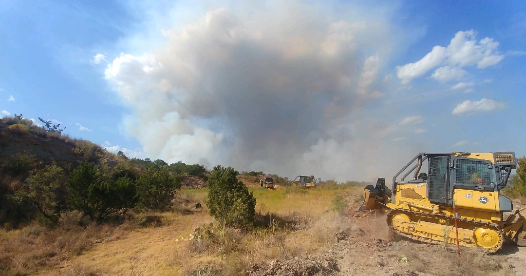
GFC is here to serve in the aftermath of all natural disasters, such as tornadoes, floods, hurricanes, wildfires from lightning strikes, etc. Drought, low humidity and high winds can also increase wildfire risks.
Wildfire & Disaster
In addition to the risk of loss of property and human life, the destruction of timber can be an expensive loss. The National Fire Protection Association offers a number of helpful tips to properly prepare.
Georgia records some 3,500 wildfires annually. There is a higher risk of wildfire in the wildland urban interface (WUI), where homes are built in wooded settings near forests and remote land. Wildfires can spread quickly and change direction rapidly, igniting brush, trees and homes.
There are actions landowners and homeowners in the WUI can take to help safeguard their property from fire, including:
- choice of building materials
- landscaping designs
- remove hazardous fuels from the forest floor and around structures
- conduct controlled prescribed burns
In the event of forest damage resulting from natural disasters, contact a forestry professional. They can assess an individual site and make a plan for salvage or reforestation.
Tracking Georgia Wildfire Activity
GFC’s Public Viewer provides an interactive map that pinpoints wildfire activity, current prescribed fires with type and size, current PM 2.5 monitor readings, NOAA HMS smoke detection, smoke forecast, and wind direction throughout the state. Details include:
- fire location
- whether a fire is active, contained or controlled
- when suppression is complete
If GFC is responding to an incident, the system syncs automatically. Wildfire incidents that are closed are not shown.
Open the GFC Public ViewerHelpful Resources
The following listings are intended to provide forest landowners with resources that can help with education and decisions following fires and the damage they leave behind.
| Title | Description | Document Type |
|---|---|---|
| Area Fire Weather Forecast | Daily forecasts with NFDRS Ratings and State-wide Fire Danger Ratings | Page on GFC Website |
| County Extension Offices | Connecting with your Extension County Office can keep you up to date with events, programs, and services just for you. | External Website |
| Daily Fire Danger Rating Map | Daily updates of fire risks across Georgia | External Website |
| Fire Weather Forecast | Current Fire Weather Forecasts and current National Fire Danger Ratings by GFC Areas | External Website |
| GEMA County Locations | In addition to county offices, the state is parceled into eight different regions for GEMA and Homeland Security response. | External Website |
| Georgia Emergency Management (GEMA) | The state’s preparedness, response and recovery agency works with public and private sector organizations to prevent and respond to natural and man-made emergencies. | External Website |
| Wildfire Damage Assessment – West Mims Fire (2017) | As of May 31, 2017 the West Mims Fire had consumed 145,315 acres (113,170 acres of federally owned land and 32,145 acres on private and industrial property). |