 Guest Blog by Jason Rucker
UAS Flight Ops Intern
My name is Robert “Jason” Rucker, and this summer, I was an intern with the Georgia Forestry Commission’s State Lands Department. I was fortunate to work on several projects, including flight operations, to help revise the Unmanned Aircraft Systems (UAS) policy, making sure it is as simple as possible while still maintaining full compliance with FAA regulations.
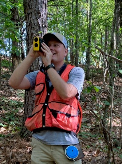
In State Lands, I learned how to cruise timber, collecting all the necessary data to establish a clear picture of the volume and type of wood available for sale, which was included in the contract for the bid package. To gather all of this data, I learned to become more effective at using a prism to determine the basal area within a given variable plot. I learned to use a hypsometer to effectively determine the merchantable and total height of trees to be cut within a plot and measure the diameter at the breast height of each tree to be cut. I also broadened my knowledge of tree species and learned how to conduct inspections on a logging site to determine if the wood being cut was per the timber prescription for that tract. This includes making sure that trees left standing have not been damaged, leaving a good amount of debris on skidding trails and decking areas to help prevent erosion, leaving stumps at the proper height, and checking the logging tickets to ensure they are being filled out correctly when loads are being hauled to the mill. I learned the importance of developing positive relationships with loggers and working through challenges they may be having to ensure the job complies with all best management practices and the prescription. This ensures that these lands are usable for future recreation and harvesting practices.
While working with State Lands, I was blessed to work with Mr. Ritchie Mullen on a water quality site inspection and Mr. Brandon Mertz on a forest health issue. We checked sticky traps for signs of emerald ash borer (EAB) in several counties, including Hall County. There, we determined EAB was positive. I also did some GPS
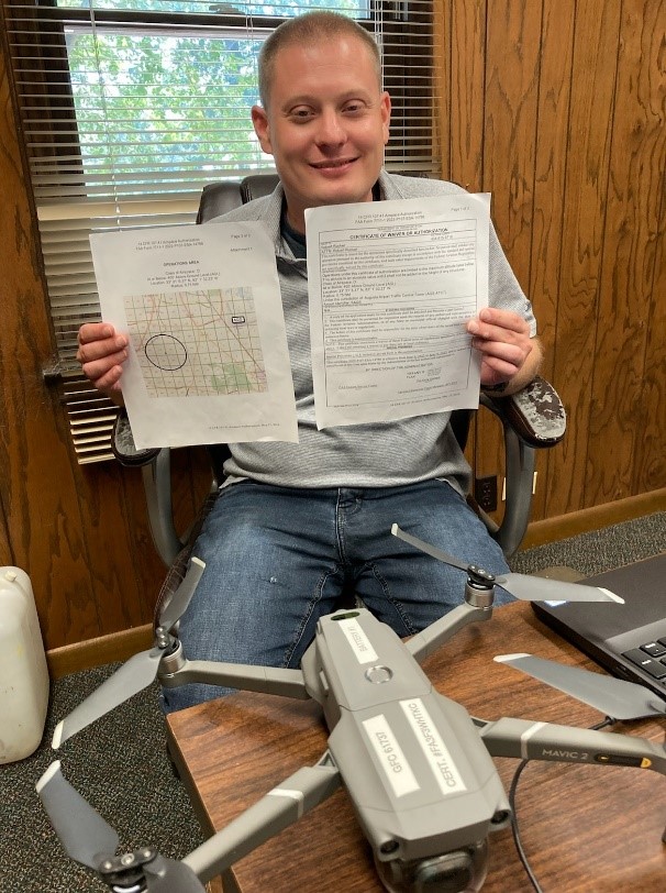
work to better lay out timber sale boundaries on the map and then mark them with flagging on site, so they were more visible. I assisted with flying our drone to create an orthomosaic map of the properties, which could be imported into ArcMap software to get imagery with greater resolution of the sale boundaries, streamside management zones, decking areas, and access roads. This gave a picture of the different types of timber (softwood or hardwood) on a property, in addition to any areas infected with beetles or fungal infections. These can also be included in the bid package to provide a visual to potential buyers and possibly increase the value of the property if other uses for the land are identified.
I went into this internship from my studies at Abraham Baldwin Agriculture College, hoping to gain a better sense of direction for my career and the education path I want to pursue. After this internship, I am excited to have the opportunity to continue working in flight ops part-time to help establish a drone policy and make it easier for different departments within the GFC to use this technology. Specifically, there is a fixed-wing drone that I am excited to get working, which can cover a large area in a very small amount of time. This could be particularly useful in Forest Health, where the technology could replace manned flights requiring a large amount of fuel to conduct flyovers to determine areas that are infected with insects such as Southern Pine Beetles and other insects or fungal diseases.
It has been a rewarding experience to work with true professionals in these different areas, learning how everything gets accomplished in so many forested areas throughout the state. I am eager to help in any capacity as I start my new role with the commission as a UAS intern while attending a graduate program at the University of North Georgia in Geospatial Science and Technology.